
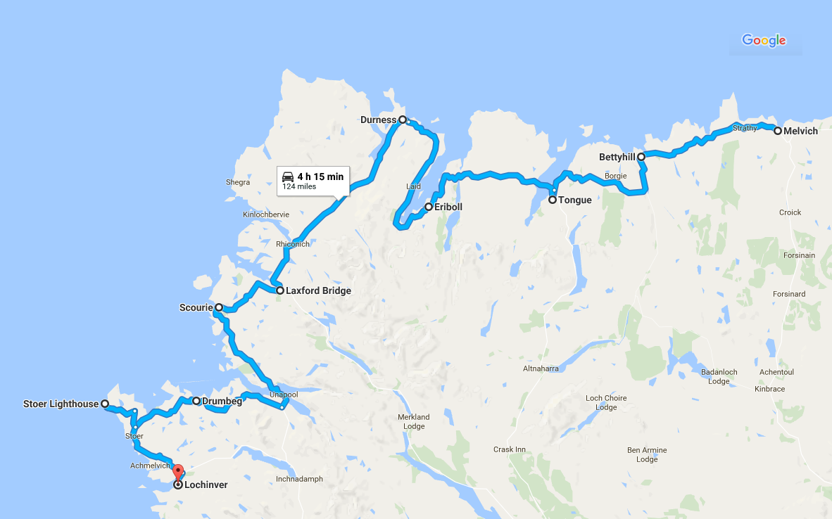
Our route from Melvich to Lochinver
Heading for the West Coast
In my first post, I wrote about our preparations for this trip. In my second post, I wrote about our first day on the North Coast 500, which ended with us turning West at John O’Groats and driving along the top of Scotland. In this post, I will describe our journey from Melvich to Lochinver, with a detour to Stoer in Sutherland on the West coast of Sutherland.
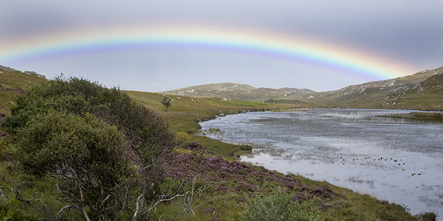
Highland Rainbow
We continued to head West on the A836 through terrain that was much more rugged. Heavy clouds were overhead and we saw rainbows every day of our trip. We were still on quick roads on this part of the journey and were making good progress.
Tongue and Loch Eriboll
In the village of Tongue, we switched to the A838, which gave us an excellent view of the ruins of Castle Varrich, which is believed to be a thousand years old.
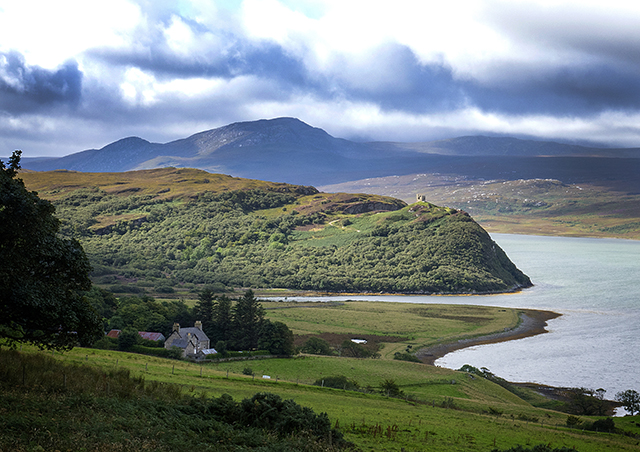
Castle Varrich
The causeway and bridge over the Kyle of Tongue were built in 1971 to replace a ferry or a 10 mile drive on a single track road.
It was in the Kyle of Tongue in 1746 that two Royal Navy ships stopped a Jacobite ship from landing French gold that was intended for Bonnie Prince Charlie. Some historians believe this this had a significant impact on his campaign to claim back the throne.
The Causeway and Bridge over the Kyle of Tongue
Some years ago, a late uncle of mine was working as a GP locum in this village. He had graduated from Edinburgh University in 1948 and was one of the first graduates to join the newly created National Health Service.
The Mail on Sunday decided to run a couple of articles, tracing what had happened to “the class of 48”. They sent a photographer to take some pictures of him. Having got the “proper” photos, the photographer suggested that – just for fun – he should take one of my uncle next to the sign for Tongue, with his tongue sticking out. This was only going to be for the family. Of course.
Guess which photo The Mail on Sunday used? My uncle had a great sense of humour and thought it was really funny.
The causeway across the Kyle of Tongue
As we headed over to the west coast, the roads became twistier and, as we travelled down the eastern side of Loch Eriboll, the road ahead became a single track with passing places. Traffic was quite light and we had no delays.
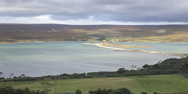
Loch Eriboll is a sea loch that is almost 10 miles long. During World War 2, the Royal Navy used it as a deep water anchorage. It enjoys much calmer weather than in the nearby seas around the Pentland Firth and Cape Wrath.
Ard Neackie in Loch Eriboll, a former ferry terminus
In May 1945, the surviving 33 U Boats of the German Kreigsmarine came in from the Atlantic and surrendered to the Royal Navy in Loch Eriboll. The majority of them were scuttled in the North Atlantic as part of Operation Deadlight.
Loch Eriboll, looking North
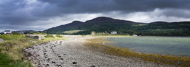
On the way between Loch Eriboll and Durness, we stopped to look at the beach at Ceannabeinne and saw a memorial to a very sad time in the history of the Scottish Highlands – the Highland Clearances. All across the Highlands of Scotland, you can see the ruins of cottages that were abandoned when the families were forcibly evicted to make way for sheep. It is one of the darker chapters in this country’s history that has had little coverage in the history books. All that remains of the village is an empty white cottage that used to be the school house.
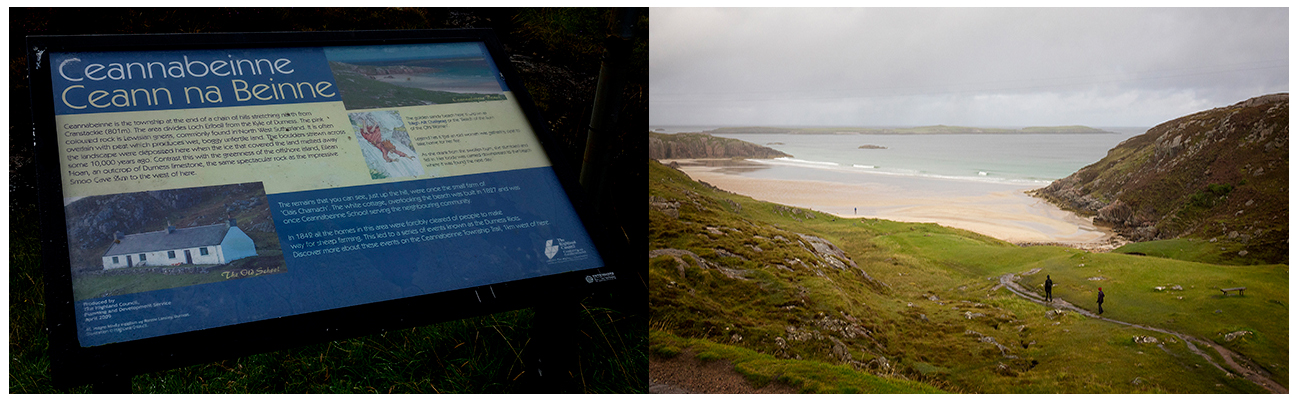
Beach and Information board at Ceannabeinne
Heading for the West Coast
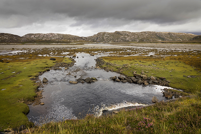
A Lochan in Sutherland
A few miles after Durness, the road became two lanes again and, at Laxford Bridge, we turned onto the A894, which would eventually take us to the West coast at Scourie. On the way, we had some incredible views. We stopped by a “Lochan” (a small loch) that was framed by a menacing sky. Not far after, I stopped to take some photos of the beautiful Loch Glendu and the Glendu Forest.
This is an area of dramatic changes in scenery; remote, wild and beautiful in equal measure. I can think of nowhere else in the UK that you can see such contrasts in scenery in such a short space of time.
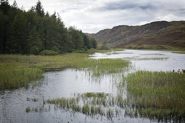
Loch Glendu and the Glendu Forest, Sutherland
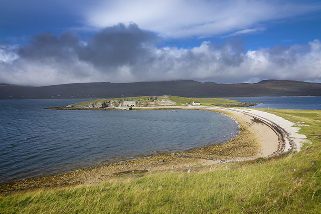
In 1984, a year after I did this trip on my own, a bridge was opened at Kylescu by HM Queen Elizabeth II, replacing the free ferry service, though you can still see one of the old ferry boats parked up at the side of Loch Gleann Dubh. Perhaps this was the one that I travelled on in 1983?
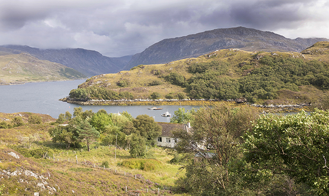
Kylescku, Sutherland, Scotland
The bridge has won awards for its design and there is a car park which gives you a good vantage point to take photos of the bridge. On one side of the car park is a memorial to the crews of the X-Craft miniature submarines, who, during World War II, trained in this area.
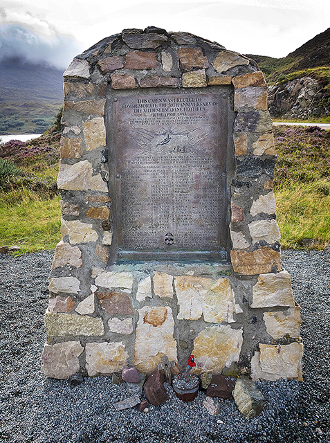
Memorial to the X Craft submariners, Kylescu, Scotland
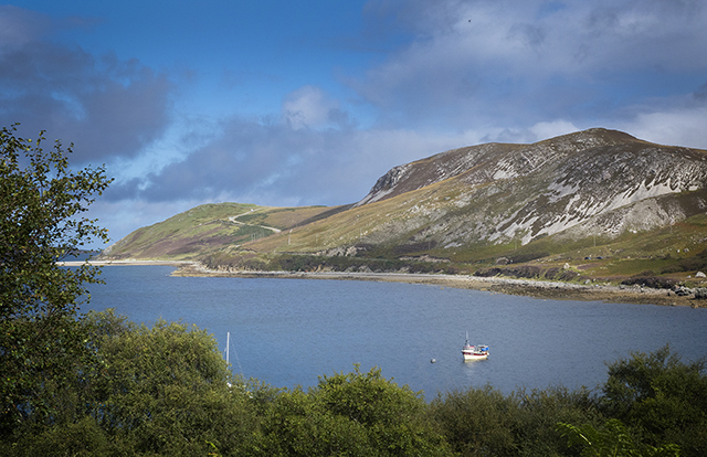
Nearby is the waterfall Eas a’ Chual Aluinn (waterfall of the beautiful tresses) which is the highest waterfall in Britain. With a sheer drop of 658 feet / 200 metres, when it is in full flow, it is three times the height of Niagra Falls.
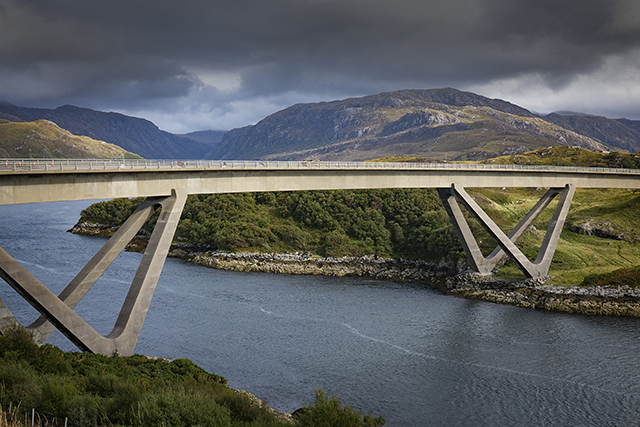
The Kylescu Bridge, Sutherland, Scotland
A short detour
Instead of staying on the A894, which would take us to Lochinver via Loch Assynt, we took the single track B869 out to the tiny village of Stoer, where my father was born in 1925. I have a family tree that goes back to 1715 and which confirms that my “Sept” of the Matheson Clan came from Assynt.
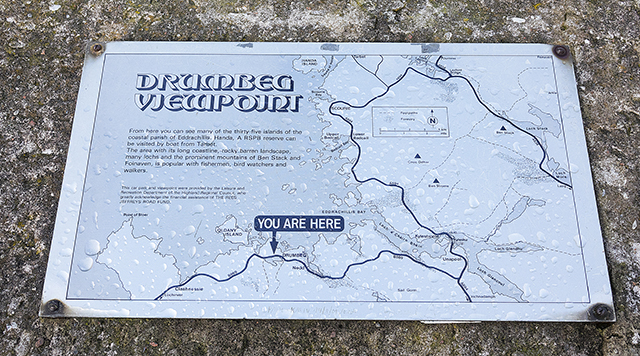
Drumbeg Viewpoint, Sutherland
I remember spending a holiday here as a very young child in a hamlet called Achnacarnin. The house we stayed in was lit by oil lamps as the hamlet did not have electricity and we drew fresh water from a well. Things are a bit more civilised nowadays in this part of Scotland.
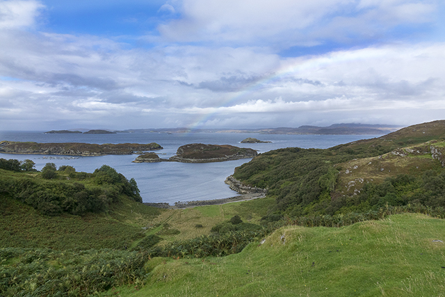
Looking out to the Atlantic from Drumbeg Viewpoint, Sutherland, Scotland
Lochinver
We spent that night at the Inver Lodge Hotel, in Lochinver, which sits on a hillside that has a wonderful view over Lochinver Harbour. This is an excellent hotel but it isn’t in the budget category, if that’s what you are looking for.
But then the 6th of September was a special birthday for my wife, Liz, so we had dinner in the Albert Roux run restaurant in the hotel. Our dinner was superb. As a rule, Scottish hotels – at all price levels – pride themselves on the quality of their food and try to showcase local produce at every opportunity. Every hotel we’ve ever stayed in, in Scotland, offers a Breakfast menu that would be a challenge to even the hungriest guest.
Including our detour, we had travelled 124 miles at an average speed of just under 29 mph.
In my next post, I will describe our journey from Lochinver to Shieldaig in Wester Ross.